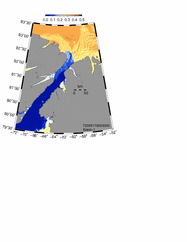
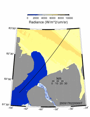
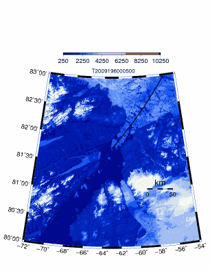
2009 Nares Strait and Lincoln Sea Ice Bridge Collapse
(Modis @250-m from 620-670 nm band-1, L1B, no corrections or flags)
Movie-1: June 25 to Aug. 25, 2009 (5.6 MB .gif, 295 frames)
Movie-2: June 25 to July 16, 2009 (4.4 MB .gif, 180 frames)
Movie-3: July 15-24, 2009 (5.3 MB .gif, 119 frames)
Maps: June-26 .pdf | July-12 .pdf | July-13 .pdf | July-14 .pdf | Image Link Table (553 individual frames)
Tracks: All July 13/14 | Track-140km | Track-10km
Data: Petermann Fjord .dat ascii | .pdf Terra
- Tasks/Goals:
- Implement Luo, Trishchenko, and Khlopenkov (2008) algorithms for high resolution atmospheric corrections
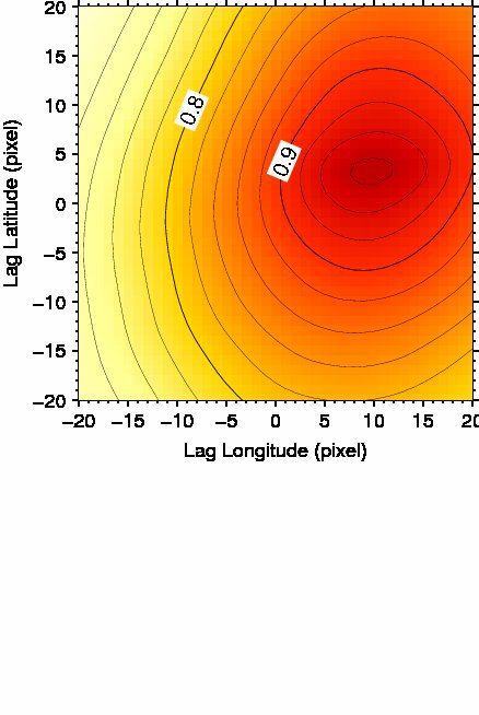
- Correct geolocation errors via spatially lagged cross-correlation of 2 successive images, e.g., r12(dx,dy)
- Feature tracking (Cayula&Cornillon)
- Tidal current predictions (Padman&Erofeeva)
- Wind observations (Hans Island?)
Resources used (see Recipe for details):
- Imagery:
- DMI Coastal Greenland Scenes (Denmark)
- MODIS Rapid Response System
- MODIS Rapid Response System (NASA)
- Software:
- SeaDas: Ocean Color, embedded IDL commands (gsfc.nasa)
- l2gen Multi-Sensor Level-1 to Level-2 Code (gsfc.nasa)
- SeaDas batch processing using bash (Cornell/Dalhousie U.)
- Modis/Airs Processing Package (U. Wisconsin)
- Data:
- Level-0 data (oceancolor.gsfc.nasa)
- Level-1 and Atmosphere Archive and Distribution System (ladsweb.nascom.nasa)
- WIST (wist.echo.nasa)
- Tools:
- Scientific Computing (Indiana University)
- Solar position and intensity (Renewable Resource Data Center, .gov)
- Satellite Overpass Predictor (NASA)
- Making movies (University of Oregon)
- Resources:
- MODIS characterization Support Team (Documentation)
- MODIS Cloud Mask
- Real-Time Polar Winds from Modis and AVHRR (U. Wisconsin)
- Modis Processing at NSIDC (National Snow and Ice Center)
- Ocean Color Coordinating Group (international)
- Space Science and Engineering Center (U. Wisconsin)
- CSIRO MODIS
- Canadian Ice Service